White Sands National Monument (Desert Week 2011)
Wednesday, 22nd June 2011 by Ian Brown
We paid a brief visit to White Sands National Monument five years ago, but with newer imagery now available, this year's Desert Week seems like a great excuse for a return visit to this absolutely fascinating field of white sand dunes, that also happens to be where the first atom bomb was detonated.
Unlike the silica-based sand that is typically the focus of Desert Week, the stunning white dunes here are the result of a rare accumulation of gypsum crystals. While this soft mineral typically dissolves in water, this unique basin valley features an ancient deposit of crystals left behind by a huge lake during the last ice age, in an area known as the Alkali Flat. (The X shape visible in this image is explained below.)

As the valley is surrounded by mountains, there is no way for water to flow to the sea, meaning that minerals are deposited on the ground, particularly in low-lying areas such as Lake Lucero, which is only filled with water after heavy rain.
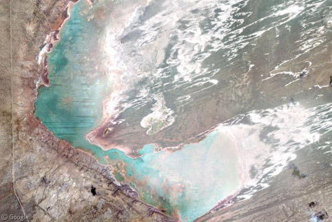
Evaporation forms large crystals along the shores of the lake and over time erosion reduces them to small granules which are blown by the prevailing south-westerly winds to form dunes, of which there are several types.
Parabolic dunes (U shapes facing upwind) are found behind the dune front, while barchan dunes (U shapes facing downwind) dominate the centre of the field.

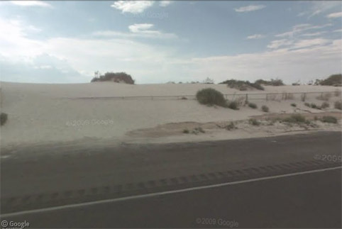
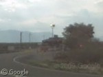
Highway 70 skirts the eastern edge of the park, so Street View allows us to see the dune front where dunes are interspersed with vegetation. We can even see the sand spilling onto the edge of the road!
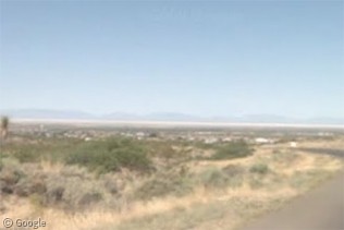
There's a visitor centre off the highway, from where you can take a scenic drive or walk through the dunes. You can also get a good view of the park from roads in the nearby mountains, with the gleaming white sands standing in stark contrast to the surrounding landscape which leads to the San Andres mountains in the distance.

For a protected National Monument1, there is a huge amount of military development here, with the White Sands Missile Range occupying land both within the park and just outside its northern and southern boundaries.
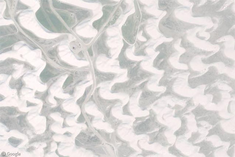
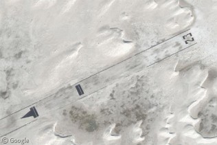
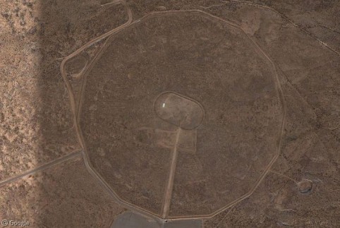
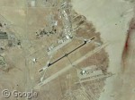
Inside the park, on the Alkali Flat, is the White Sands Space Harbor - a training site for Space Shuttle pilots. A pair of 10km long runways (the X in an earlier image) can act as emergency landing sites should the Shuttle's usual landing locations be unavailable. The point where the runways cross, and the markings at the end of each runway, are clearly visible. Presumably it must be a constant challenge to keep the runways clear of the shifting sands.

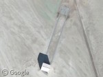
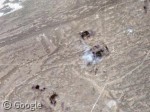
The Space Harbor is part of the larger White Sands Test Facility, a NASA program with a wide range of capabilities such as altitude simulation and propulsion testing. A number of locations are visible, including a row of H-shaped markings, the purpose of which isn't clear.
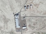

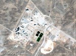
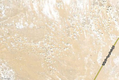
To the south of the park, the White Sands Missile Range has a large facility accessed via a gatehouse off the highway. There are markings all around the area which are likely the result of missile tests.
The northern part of the missile range extends a considerable distance and includes the Trinity test site, where the first ever atom bomb was detonated. We mentioned the test site in our original post, but the quality of Google's images has improved considerably since then!
One additional military installation can be found to the east of the park - the Holloman Air Force Base and High Speed Test Track which we also visited a couple of years ago.
You can learn more about White Sands National Monument at Wikipedia and the park's official site.
-
A National Monument is similar in status to a National Park, but can be defined by the US President without Congressional approval. While the landscape is safeguarded, wildlife in National Monuments is less protected than in a National Park. ↩︎
About the author
Ian Brown lives in Ottawa, Canada, and spends his spare time perusing maps to find new routes to ride on his orange bicycle.

The 8 H’s are helicopter landing spots. Given the airfields emergency role for both shuttle and military aircraft the midfield position is ideal for emergency equipment. Shuttle crew is 6-8 per mission. The color of the sand is hard to distinguish from pavement which is why this field has H’s.
Brian – I was wondering if they were helicopter pads – they just seem a bit redundant when you’ve got such a vast flat area that they could land anywhere!
It is redundant, but if the aircraft breaks-apart there is no space for helicopters. They can not land on debris. Also a fixed location is easier to direct a pilot and ground crews to, especially in a crisis.