The World’s Largest Desert: Antarctica
Wednesday, 23rd June 2010 by Matt Bucher
When one thinks of Antarctica, the word "desert" probably does not come immediately to mind. We think of deserts as hot, sandy, sun-drenched places. However, the technical definition is just a place that receives very little precipitation, less than 250 millimetres (10 inches) per year. So there are "hot deserts" and "cold deserts" and that means the vast majority of our southernmost continent is indeed a desert—the world's largest.
Overall, the continent is about 14 million square kilometres (5 million square miles)—most of it desert. That's larger than all of Canada (10 million sq km/3.8 sq. m), but smaller than all of Russia (17 million sq km/6.5 sq. m).
As you can imagine, Google has very little detailed imagery of Anatarctica. The surface of Antarctica is 98 percent ice sheet and 2 percent barren rock, so the imagery from high altitudes does not reveal much beyond shades of white and gray.
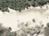
Probably the most popular spot from which to depart for Antarctica is Ushuaia, Argentina (the capital of Tierra Del Fuego, and often regarded as the southernmost city in the world). Nearest Ushuaia are the South Shetland Islands and the Antarctic Peninsula.
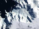
There you can see some exposed rock and the coastline—which, because of evaporation, receives slightly more precipitation than the inland areas.
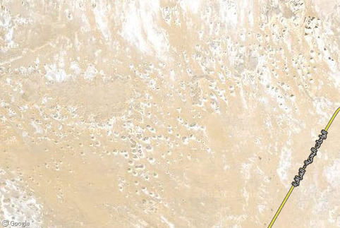
In the central, inland ice shelf, Google does have highly zoomable maps—they just look like abstract art. Here's an image where one inch equals approximately ten metres (32 feet).

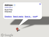
Not too exciting, just miles and miles of ice. And here's the South Pole:
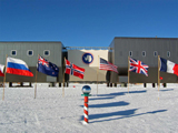
The South Pole has no indigenous wildlife at all, but it does have a major scientific base nearby, South Pole Station. We have previously featured maps of several other Antarctic stations, but there does not appear to be an updated image of South Pole Station. Perhaps if Google decides to take their Street View snowmobiles on an excursion we would get images like this:
About the author
Matt Bucher is a writer and editor living in Austin, Texas. He runs the Street View blog Apres Garde and can be found at http://mattbucher.com
Cool! I told ma friends that Antarctica’s the world’s largest desert but they didn’t agree. Now, they’ll if I show the proof!